


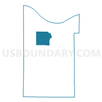
Voting District 0314082000001, Cheboygan County, Michigan
About
Outline

Summary
| Unique Area Identifier | 596208 |
| Name | Voting District 0314082000001 |
| County | Cheboygan County |
| State | Michigan |
| Area (square miles) | 37.20 |
| Land Area (square miles) | 33.86 |
| Water Area (square miles) | 3.34 |
| % of Land Area | 91.01 |
| % of Water Area | 8.99 |
| Latitude of the Internal Point | 45.58873120 |
| Longtitude of the Internal Point | -84.54584020 |
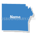
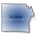
Maps


Graphs
Select a template below for downloading or customizing gragh for Voting District 0314082000001, Cheboygan County, Michigan


Neighbors
Neighoring Voting District (by Name) Neighboring Voting District on the Map
- Voting District 0310172000001, Cheboygan County, MI
- Voting District 0310650000001, Cheboygan County, MI
- Voting District 0310742000001, Cheboygan County, MI
- Voting District 0311198000001, Cheboygan County, MI
- Voting District 0311500000001, Cheboygan County, MI
- Voting District 0311500000002, Cheboygan County, MI
- Voting District 0313748000001, Cheboygan County, MI
- Voting District 0315610000001, Cheboygan County, MI
- Voting District 0315628000001, Cheboygan County, MI
Top 10 Neighboring County Subdivision (by Population) Neighboring County Subdivision on the Map
- Cheboygan city, Cheboygan County, MI (4,867)
- Benton township, Cheboygan County, MI (3,206)
- Inverness township, Cheboygan County, MI (2,261)
- Mullett township, Cheboygan County, MI (1,312)
- Beaugrand township, Cheboygan County, MI (1,168)
- Aloha township, Cheboygan County, MI (949)
- Burt township, Cheboygan County, MI (680)
- Munro township, Cheboygan County, MI (571)
- Hebron township, Cheboygan County, MI (269)
Top 10 Neighboring Place (by Population) Neighboring Place on the Map
Top 10 Neighboring Unified School District (by Population) Neighboring Unified School District on the Map
- Cheboygan Area Schools, MI (14,220)
- Inland Lakes Schools, MI (6,097)
- Pellston Public Schools, MI (5,281)
Top 10 Neighboring State Legislative District Lower Chamber (by Population) Neighboring State Legislative District Lower Chamber on the Map
Top 10 Neighboring State Legislative District Upper Chamber (by Population) Neighboring State Legislative District Upper Chamber on the Map
Top 10 Neighboring 111th Congressional District (by Population) Neighboring 111th Congressional District on the Map
Top 10 Neighboring Census Tract (by Population) Neighboring Census Tract on the Map
- Census Tract 9603, Cheboygan County, MI (4,200)
- Census Tract 9604, Cheboygan County, MI (3,629)
- Census Tract 9602, Cheboygan County, MI (2,982)
- Census Tract 9601, Cheboygan County, MI (2,979)
- Census Tract 9605, Cheboygan County, MI (2,750)
- Census Tract 9606, Cheboygan County, MI (2,475)